by Skip Via
skip@westvalleyaturalists.org
To take a virtual tour of the West Valley area, click here
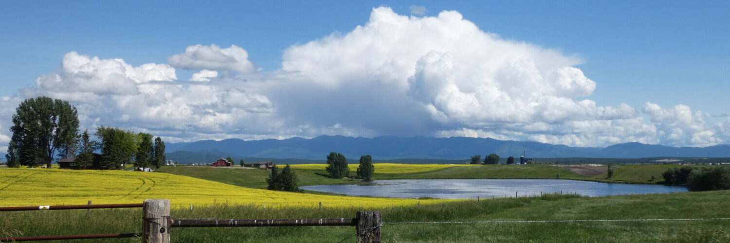
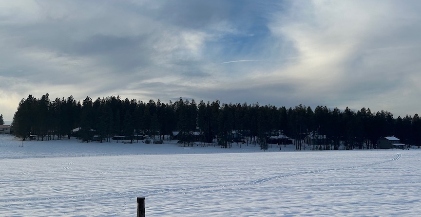
Here in the Flathead Valley, we’re fortunate to be able to enjoy a richly varied landscape—craggy mountains, rolling hills, swift rivers and meandering streams lined with brightly colored stones, a sprawling valley floor punctuated with the occasional boulder or with massive rock outcroppings displaying multiple bands of colors and textures, clearwater lakes fed by springs or seasonal precipitation, wetlands that provide shelter and food for our avian residents. It’s a rare day that I’m not struck by the immense beauty of our valley.
But do you ever wonder how it got this way?
There are many forces that shape the landscapes that we inhabit. Some of these—for example, weather and climate, human habitation and development, wildlife behaviors, activities such as farming, mining and logging—cause changes that we can see in real time. Others take much longer and may require some detective work to realize and understand. This article will focus on those forces that have had the greatest long-term effects on the places that we call home—plate tectonics, geologic faulting, and glaciation.
Plate Tectonics
Folks in my age bracket (remember when the Beatles were on Ed Sullivan?) grew up hearing about continental drift—the theory that the continents as we know them today were once part of a single landmass called Pangaea that separated and drifted apart over time. This theory explained why parts of our existing continents fit together like jigsaw puzzle pieces and why fossil records show the same flora and fauna appearing across widely separated continents. But there was a major problem with this theory—it provided no acceptable mechanism for explaining HOW the continents broke up and drifted apart.
Enter the theory of Plate Tectonics. We now know that the continental landmasses sit atop tectonic plates—huge masses of rock that float across the globe, crashing into, rubbing up against, or overriding each other, all driven by the ongoing creation of new land being forced outward along the mid-oceanic ridges, plate boundaries, or rift valleys that slice across the globe. Our planet’s earthquake activity, volcanism, and mountain formation are a direct result of this continuing interaction of plates interacting with each other. When push comes to shove, something has to give.
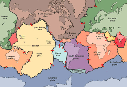
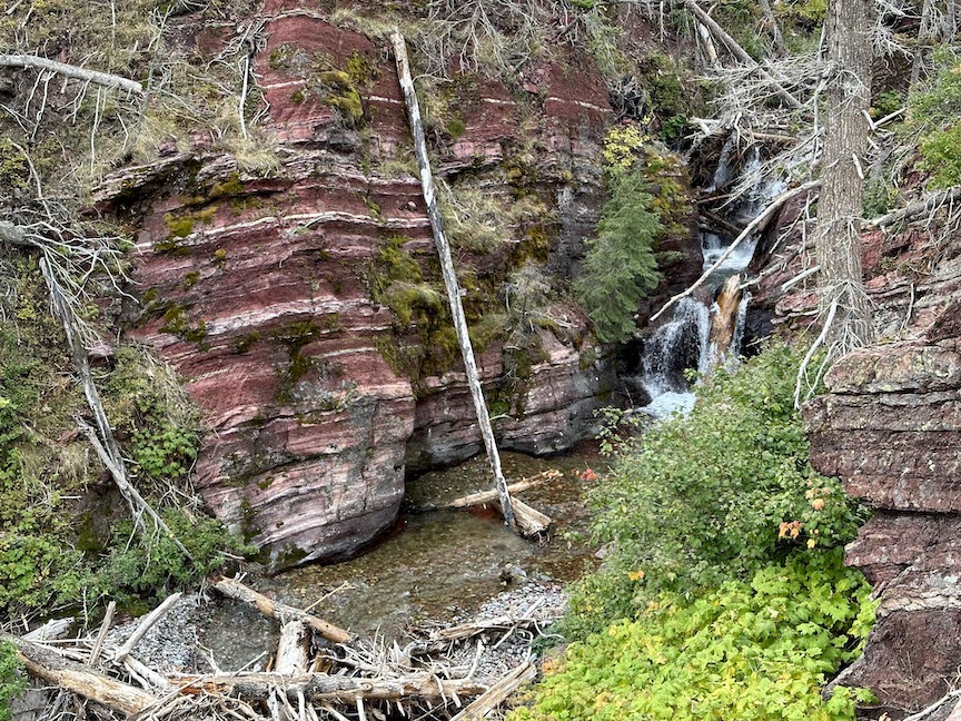
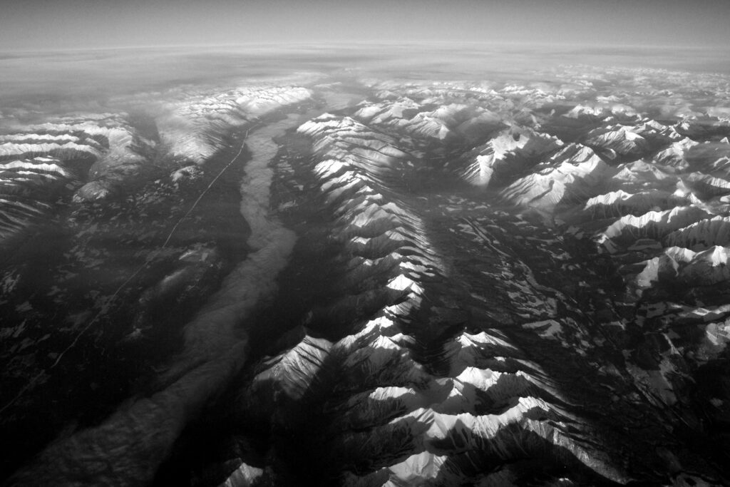
In the case of our valley, this pushing and shoving resulted in the Lewis Overthrust. The Lewis Overthrust began forming about 170 million years ago when the Farallon tectonic plate was pushed against edge of the North American plate. (More on the Farallon plate, not shown in the image above, may be found here.) In a process called subduction, the Farallon plate was forced underneath the North American plate. This caused the deep, billion year old mudstone strata that formed on the floor of the Belt Sea (which once covered most of Montana and the mountain west) to rise up, fold, and override the younger Cretaceous shale of the plate. The much older Precambrian rock of the Lewis Overthrust now sits atop the younger rocks of the North American plate in our valley, terminating at Marias Pass and Chief Mountain. We call this mudstone argillite—the beautifully colored, often banded rock that is prevalent all over our valley and that comprises virtually all of the exposed rock in the valley and as far east as Glacier National Park. This article—All About Argillite—provides a much fuller explanation of the formation of the argillite that makes up most of the visible rock in our valley. We’ll see later how glaciation affected the form and distribution of argillite in the Flathead.
This subduction also contributed to the rise of the Rocky Mountains, of which our local Mission, Swan, Salish and Whitefish ranges are a part. And that brings us to geologic faulting as a shaper of the landscape in the Flathead Valley.
Geologic Faulting
Faults are created when a rock mass in the Earth’s crust is fractured by tectonic forces, creating a break in the rock mass along which the now discontiguous pieces of the mass can move relative to each other. There are basically three types of forces that create faults:
- Compression – when one plate crashes into another. This is a vast oversimplification of a complex process, but generally two things can happen: both plates are uplifted (this the process that is currently forming the Himalayas) or one plate overrides the other, as in the case of the Lewis Overthrust, above;
- Tension – when two plates are moving away from each other, as they do along the mid-oceanic ridges or the Great Rift Valley; and
- Shearing – when two plates slide horizontally against each other. The San Andreas Fault is a well-known example of this phenomenon.
Additional faults may also be created as a result of these processes. For example, an earthquake can cause new local faults to form in the substrata or surface strata of an area. These faults are sometimes referred to as “normal faults.” This process of faulting is one of the major contributors to the present day landscape of the Flathead Valley.
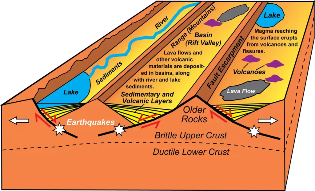
About 40 million years ago, the land under our valley was stretched horizontally east-west. This process thinned out the bedrock under the local mountain ranges causing faults to form at the edges of the mountains as the pressure from the massive ranges pushed down on the thinned bedrock. The valley floors were lowered as the land slid vertically along the faults. As the mountains rose, the valleys fell. This created the Basin and Range topography that we see every day here in the valley. This article – Basins and Ranges – explains this process more thoroughly. The Whitefish, Swan, and Mission mountains to the east and the Salish mountains to the west form the boundaries of this topography.
The Salish MOUNTAINS, you ask? Aren’t they really more like hills, especially in comparison to the mountains to the east? For the answer, let’s turn to the third major phenomenon that formed our valley–glaciation.
Glaciation
It’s not difficult to understand why it seems like every third business in the valley is named Glacier [insert business venture here]. In addition to our proximity to Glacier National Park, many of the landscape features we encounter every day are the result of glacier activity in the valley.
The first thing to understand about glaciation is that it was not a one-time occurrence. Glaciers ebb and flow over the same territory as they retreat and rebuild according to climatic conditions. When we talk about glaciation in the valley in this article, we’re lumping all of those variances into one process.
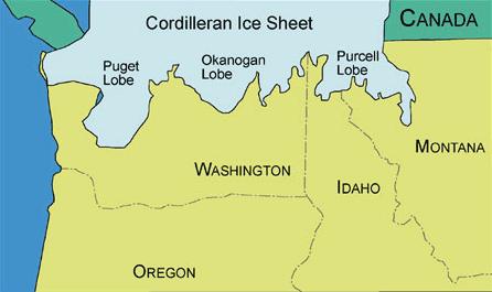
Northwest Montana and the Flathead Valley was last glaciated around 17,000 years ago when the Cordilleran Ice Sheet made its largest advances in North America. Glaciers up to 4,000 feet deep covered the Flathead Valley and extended east to the Rocky Mountains, filling the Rocky Mountain Trench from Flathead Lake 1,000 miles north to northern British Columbia.
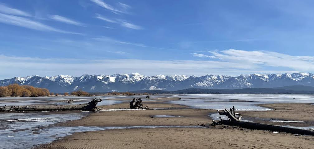
Along the continental divide in Glacier NP, the Cordilleran sheet merged with the much larger Laurentide Ice Sheet, forming a massive sheet of ice holding more water than the Antarctic Ice Sheet does today, In the image above (not labeled), the southeastern-most lobe of the Purcell Lobe was called the Flathead Lobe. This lobe extended to present day St. Ignatius, where you can clearly see the glacier’s terminal moraine. The rapid melting of the Cordilleran Sheet was instrumental in the fascinating story of Glacial Lake Missoula–the series of massive outflows that created the Columbia River Gorge. But we can see the remnants of Glacial Lake Missoula here in the valley. It’s called Flathead Lake.
“File:Rocky Mountain Trench (6450215327).jpg” by Shawn from Airdrie, Canada is licensed under CC BY-SA 2.0.
Back to the Salish Mountains. They were once nearly as large as the Swans, but glacial activity sheared off the tops and created the unique argillite and limestone terraces that are common there. And if you look south from a high vantage point in the valley, you’ll see the beginnings of the Mission Range, which appear in the valley as Salish-sized hills hardly worthy of being part of the same majestic range we see around Polson. This part of the Mission range suffered the same fate as the Salish Range–the Flathead Lobe of the Cordilleran Glacier sheared them off.
So why do the Swan and Whitefish Ranges look so different? The glaciers didn’t quite overtop those ranges, leaving the peaks formed during the Lewis Overthrust intact–and also leaving some pre-glaciation flora there that do not appear elsewhere in the valley.
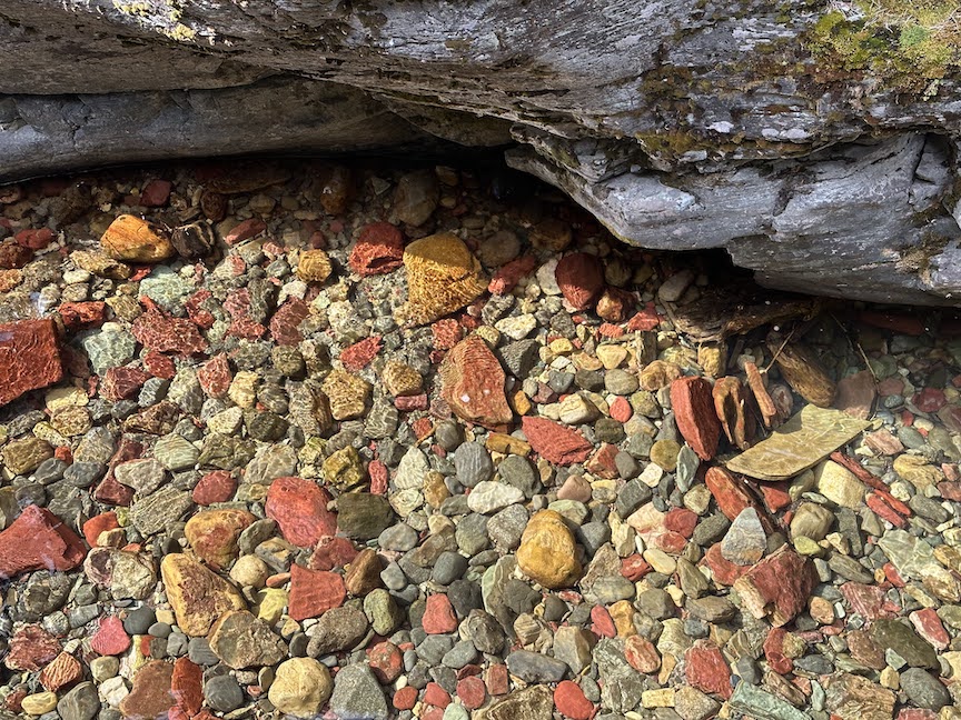
Glaciers were responsible for many other aspects of our landscape. The moving ice sheets scoured the valley, creating boulders and stones of argillite and other rocks (quartzite and limestone, primarily) that were distributed along the valley floor. As the glaciers ebbed and flowed, the rocks were ground more and distributed in random fashion across the landscape, mixing the reds with the blues and the greens and the yellows and the grays. Rivers and creeks quickly rounded the soft, smaller stones into smooth shapes while transporting them to new locations. The wonderful mix of argillite colors throughout the valley bodies of water is the result of these processes.

Lone Pine State Park offers magnificent views of the valley floor. Next time you’re there, look for glacial drumlins–oval- or teardrop-shaped hills deposited in the valley by glaciers. They are made of glacial till–rocks, clay and sand that are trapped within glaciers and deposited as the glaciers melt or retreat. The exact process of this deposition is not known. The prevailing theory is that the till is deposited under the edges of glaciers as water melts and flows around the deposit. Drumlins are typically higher and more bulbous on the back end and lower and pointed on the other, indicating the direction of travel of the glacier that formed them.
My house is on a drumlin, and I can attest that at least this one is comprised of LOTS of rocks, from marble-sized to boulder-sized. You can see this drumlin looking northwest from the intersection of Old Reserve and West Valley, behind the Stiles barn. Due to their shape and rocky composition, they’re often not farmed, so one way to recognize them in the valley is from the tree cover.
Glaciers are also responsible for the mineral rich soils that we find in the Flathead. Minerals were ground into fine particles by glacial activity and became part of the soil on the valley floor.
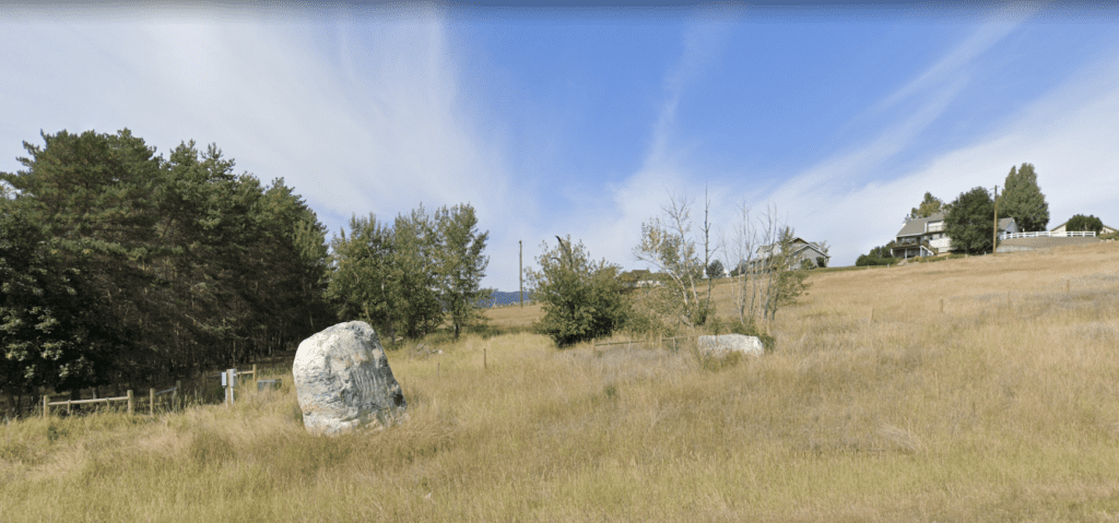
Finally, if you are out hiking or driving and see a boulder that looks like it doesn’t belong there, you’re probably looking at a glacial erratic. Glacial erratics are rocks that have been moved by glacial action from their original location to a new one. Very large ones are not especially common in West Valley, but they do occur. Many of the rocks that farmers encounter when they plow land in the valley are erratics because they have been moved from their original location by glaciers dislodging them and dragging them. Argillite rocks from the Flathead Valley have been found as far away as the mouth of the Columbia River gorge, having been transported there when the 2,000 foot tall ice dam that formed Glacial Lake Missoula burst about 13,000 years ago and sent billions of gallons of water–pushing and carrying rocks of various sizes–down the gorge. That would have been something to see–and it may actually have been witnessed by humans, according to some stories.
A (VERY Oversimplified) Geologic Timeline
| TIME | PROCESS |
| 1.5 billion years ago | Silt and clay was deposited on the floor of the Belt Sea–in some places up to three miles thick–and was compressed into mudstone and shale. |
| 170 million years ago | The Farallon tectonic plate was subducted under the North American plate, creating the Lewis Overthrust. |
| 20 million years ago | The bedrock under the Flathead Valley was stretched horizontally, forming the Basin and Range topography that comprises the basic structure of our valley. |
| 17,000 years ago | The Cordilleran Ice Sheet reached into northwestern Montana and into the Flathead Valley, shearing mountaintops and scouring the bedrock. |
| 15,000 – 13,000 years ago | The ice dams that formed the massive Glacial Lake Missoula burst and sent walls of water to the Pacific via the Columbia River gorge. |
Thank you for this wonderful explanation of the geologic formation of our area! Would you consider hosting a driving tour of some of the land formations that were the result of these occurrences?
Thanks for the kind words. I’ll certainly consider a driving tour. Perhaps I can enlist someone from TVCC who is more expert than I am on these matters.